' d='M0 0h21v15H0z'/%3E%3Cpath fill='url(%23b)' d='M10 0h11v15H10z'/%3E%3Cpath fill='url(%23c)' d='M0 0h7v15H0z'/%3E%3Cpath fill='url(%23a)' d='M7 0h7v15H7z'/%3E%3C/g%3E%3C/svg%3E)
VirtualTer will be available in French and English, with simultaneous translation.
–
Registration will close at midnight on 20 May 2025 and there will be no on-site registration.
VirtualTer 2025
26, 27 & 28 mai 2025
University of Caen Normandy
– Campus 1 –
Digital twin: your territory of tomorrow
Presentation
VirtualTer 2025
Why VirtualTer
VirtualTer 2025, by whom?
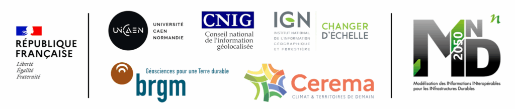
VirtualTer 2025 is co-organised by BRGM(*), Cerema(*), CNIG(*), IGN(*), the University of Caen and MINnD2050(*).
(*) BRGM: Bureau de recherches géologiques et minières (Geological and Mining Research Bureau) | Cerema: Centre d’études et d’expertise sur les risques, l’environnement, la mobilité et l’aménagement (Centre for studies and expertise on risks, the environment, mobility and development) | CNIG: Conseil national de l’information géolocalisée (National council for geolocalised information) | IGN: Institut national de l’information Géographique et forestière (French National Institute for Geographic and Forestry Information) | MINnD2050: Modélisation des informations interopérables pour les infrastructures durables (Modelling interoperable information for sustainable infrastructures)
Why VirtualTer 2025?
VirtualTer 2025 aims to be an event representing the national and European ecosystem of reference on digital twins, from buildings and infrastructures to the territory in all its components of development and adaptation.
VirtualTer 2025, for whom?
This event is aimed at elected representatives and decision-makers, from the State to local authorities, as well as all professionals working in the fields of construction and public works, geomatics, the environment, digital technology, the ecological transition, etc. Collaboration, decision support and pooling, as well as climate change and the necessary adaptations, and discussions and projects relating to connected and sustainable territories, are just some of the issues that will be addressed during VirtualTer 2025.
Why VirtualTer 2025 in Caen?
The University of Caen is a national benchmark for the management of its property assets, with a BIM/CIM approach and associated digital mock-ups. The implementation of digital twins on its territory is very topical.
Campus 1 (one of five campuses in Caen), which is hosting VirtualTer 2025, is representative of the University’s heritage approach and is located in the city centre. It is well served by public transport.
Caen and Caen la mer are directly concerned by the issue of climate change, and are working on adaptation scenarios that call into question certain urban development projects (retreat of the coastline, marine submersion, heat islands, etc.). The digitisation/modelling of the territory is therefore a topical issue.
2025 is also the year of the millennium: CAEN is 1000 years old! The first recognised historical reference to Cadomus (the Latin name for Caen) dates back to 1025.
Register for VirtualTer 2025
Registration for VirtualTer 2025 is free, as it is a non-commercial event, but registration is compulsory, as the number of places is limited. It is also a face-to-face event to be held on Campus 1 of the University of Caen.
Program
VirtualTer 2025
VirtualTer 2025 takes place over 4 themed half-days, from 1.00 pm on 26 May to 1.00 pm on Wednesday 28 May.
The programme includes keynotes, conferences, round tables and workshops.
Monday MAI 26TH | 2.PM – 6.30 PM
Welcome and introduction to VirtualTer 2025: Mr. Lamri ADOUI, President of the University of Caen Normandie and President of France Universités.
Providing France with sovereign territorial digital twins, co-constructed by the State and local authorities, is essential to the deployment of a digital usage strategy that accelerates the ecological transition.
VirtualTer 2025 opening conference: Mme Valérie NOUVEL, Vice-President for Transition and Adaptation to Climate Change at the Conseil Départemental de la Manche and former President of the Mission sur les territoires connectés et durables (Mission on connected and sustainable territories).
Mr Lamri ADOUI –
President of Caen University
Mme Valérie NOUVEL – Vice-President at the Conseil Départemental de la Manche
Digital twins: the state of play in France and Europe
14H25 - 14H55 : A national community for the Digital Territories Twin: CNIG / MINnD2050 / IGN working group and outlook
Rémi MONTORIO
Director of Geographic Projects
Maud GUIZOL
Group BIM and CIM Director
A look back at the work and results of the national working group on Territorial Digital Twins (JNT). Vocabulary/definitions, use cases, data, standardisation, architecture, tools… these are just some of the topics addressed over the past year by public and private players from the Data, BIM and geomatics communities. We’ll be looking back at the feedback we’ve received, the challenges we’ve faced and the obstacles we’ve identified, while also outlining the prospects for the emergence of common ground and the convergence of initiatives. This community is still open, so come and join us!
Organisation : Métropole Européenne de Lille, Colas
15H00 - 15H30 : Inventory of digital twins in France and Europe (EDIC Ltd CitiVerse)
Sophie HOUZET
Director of Fabric'O
Information to come.
Organisation : Cerema
15H35 - 16H05 : Monitoring the reduction of intra-urban heat islands on the surface of grey, green and blue infrastructure assets modelled using CIM information and integration into the digital twin of a resilient site in the City of Montreal.
Richard MONGEAU
Simon GIGNAC
Team Leader
Cartography and photogrammetry surveyor
In response to the objectives of the City of Montreal’s 2020-2030 Climate Plan, research in design sciences has led to the development of an artefact to improve the adaptation of urban areas to heat waves. A digital shadow connected to an air temperature sensor is created from a GIS incorporating an inventory of road and park assets classified as mineral and plant surfaces, to which an attribute quantifying intra-urban heat islands is added. A demonstration of the monitoring of the evolution of surfaces and their thermal state, before and after the construction of the assets of the City of Montreal’s flagship sustainable development project, is presented.
Organisation : ÉTS Montréal (École de Technologie Supérieure), Ville de Montréal
16H40 - 17H10 : The Vendée Digital Twin: Collaborative Governance for an innovative and resilient region
Simon GUILLOTON
Data/Geomatics Project Manager
The Vendée is developing an ambitious Departmental Digital Twin for territorial management and energy transition. Supported by the department, major trade unions and Géo Vendée, this departmental alliance has structured the project. This digital twin is based on four pillars: a LoRa network, a shared data hub, the development of its in-house ETL: GV Live, and the 3D visualisation and simulation platform. The success of this approach is based on the pooling of skills and infrastructure, made possible by this single governance structure, opening the way to numerous use cases for a more efficient, resilient and sustainable Vendée.
Organisation : GéoVendée
17H15 - 17H45 : The Digital Twins of the Territory: State of play and challenges in Switzerland
Laurent NIGGELER Directeur et Géomètre cantonal.
Since 2022, Switzerland has been exploring the use of digital twins of the territory (JNT) to improve territorial management and planning. This presentation will present the results of a study on the adoption and maturity of JNTs in Switzerland, highlighting the main challenges encountered. We will also analyse the accelerating factors.
Organisation : République et Canton de Genève
17H50 - 18H20 : User control and land modelling - The example of Miquelon-Langlade (Saint-Pierre et Miquelon)
Margot LIEBEL
Cheffe de projet
Information to come.
Organisation : Métamorphoses Urbaines
Tuesday MAY 27TH | 8.30am – 12.30pm
KEYNOTE : Humans at the heart of digital twins? Deconstructing utopia to make it a reality
The promises of increased citizen participation thanks to territorial digital twins sound like a litany. These hopes draw their strength from the founding myths of digital twins, which are regularly revived by new artefacts: AI and the ‘human’ at the moment. However, to really engage citizen-users, it is not enough to refine models, accumulate data or optimise graphic realism: the key lies in the plurality of modes of engagement offered to different audiences, often drawn from digital traditions other than those of a territorial digital twin.
Jean-François LUCAS – Doctor of Sociology / Managing Director of Renaissance numérique
Digital infrastructures and territories, a challenge for national cooperation
9H20 - 9H50 : Asset management: from BIM (Building Information Modeling) to CIM (Campus Information Modeling)
François CAUMONT
Director of Assets and Logistics (DPL)
Christophe BAUMGARTEN
Head of the CAD-BIM Division (DPL)
Building Information Modeling (BIM) is now a key tool for building lifecycle management. In addition to design and construction, BIM has very practical applications in the operation and maintenance phases.
City Information Modeling (CIM), or as we call it, Campus Information Modeling, is the natural extension of BIM to the urban scale. It is based on the same foundations: data-enriched 3D modelling, collaboration and lifecycle management. But it applies to infrastructure, networks, outdoor facilities and urban spaces.
Organisation : Université de Caen
9H55 - 10H25 : Collaboration, BIM and GIS: building Quebec City's digital territory
Jean LEMAY
Division Director
Property Management Department
Quebec City is deploying an integrated strategy for the digital transformation of its assets, combining BIM, GIS and digital twins. This conference will present the technical and organisational levers that have been put in place: collaboration, adoption of ISO standards, integration of 3D data into geomatics systems and research partnerships. The aim is to improve the planning, design and operation of urban areas thanks to information that is structured, interoperable and shared between public players and private partners.
Organisation : Quebec City
Round table 1 :
Meeting the challenges of regional planning –
Articulation and complementarity of data between territorial modelling (2D/3D) and digital twins produced by different players - Collaboration, the key to optimising investment in territories.
Opening: Pierre-Yves LEPAGE (SNCF Réseau) – Designing the Digital Twin of bridges: for data continuity and inclusion in a complex system
Participants:
- Valérie NOUVEL (Vice-President of the Conseil Départemental de la Manche) –> awaiting confirmation
- Sébastien SORIANO (Chief Executive Officer of IGN)
- Catherine LAGNEAU (Chairman and CEO of BRGM)
- Jean-François GAUTHIER (Chairman and CEO of IGN Quebec)
Nathalie OZENNE
Entrepreneuse
Minute papillons
Pierre LAULIER
Secrétaire général
CNIG
Workshops 1 et 2
The four workshops are designed to provide an opportunity for trade professionals to exchange views and ideas. They will last 45′ and will be held in parallel with certain conferences on Tuesday morning and Tuesday afternoon.
Workshops 1 and 2 will take place at the same time in two different rooms in the main amphitheatre.
They will be co-hosted and a report of the discussions will be drawn up.
The number of participants per workshop is limited to 20, and attendance will be by registration (a special registration form will be sent to all VirtualTer 2025 registrants).
| Workshop | Schedule | Title | Animation |
|---|---|---|---|
| 1 | 9H30 – 10H15 | Uses and data of digital models and digital twins of territories | Maud GUIZOL (Colas) Yvon KILA (Ferrcad) |
| 2 | 9H30 – 10H15 | Challenges and obstacles to the implementation of BIM and territorial digital twins | Xavier FODOR (Twin+) Michel BERNARD (SIGMAG) |
Tuesday MAY 27th | 1.45 PM – 5.45 PM
Digital mock-ups, 3D modeling, digital twins: tools for collaboration, decision support and regional pooling
Round Table 2 : 14h - 15h30
Urban resilience and climate change – Digital twins as a support for public policy (decision support) and a tool for informing citizens
Participants:
- Philippe AUVRAY (President of Te61 – Orne energy territory)
- Yolande CHAVANE (Director of the Data & Transformation programme – SGPE)
- Bertrand MONTHUBERT (Chairman of the CNIG)
- Pascal BERTEAUD (Chief Executive Officer of Cerema)
Animation: Nathalie OZENNE / Pierre LAULIER
Nathalie OZENNE
Entrepreneuse
Minute papillons
Pierre LAULIER
Secrétaire général
CNIG
16H05 - 16H35 : Mapping and digital twins of territories for insurance risk assessment
Nathalie ORLHAC Référente SIG
Information à venir.
Organisation : CCR – Caisse Centrale de Réassurance
16H40 - 17H10 : Ethical use of geolocated data and information
Hervé HALBOUT
GIS, BIM, 3D modelling consultant, JNT
Anthéa SÉRAFIN
Data and AI ethics referent
Talking about ethics for geolocalised data – and even more so for the information derived from it – raises questions about the production and use of such data. The implementation of digital twins of territories, particularly when they are represented in 3D, means that the question of ethics has to be taken into account from the project phase onwards, and that usage data has to be tested. The potential biases that an AI may carry for interpreting these digital twins, or even updating them, is also a subject that needs to be addressed.
Organisation : HALBOUT Consultants, ekitia
17H15 - 17H45 : When a site threatened by the current coastal transgression illustrates the climatic and environmental data from the beginning of the last Ice Age and the lifestyles of Neanderthal populations around 80,000 years ago.
Dominique CLIQUET
Archaeologist, Curator of the Rozel site – Manche
The Middle Palaeolithic site at Le Rozel is currently the site in the Great West of France that provides the most information on palaeoenvironments, the management of occupied space and the formation of human groups, enabling palaeo-ethnographic studies that are rarely possible for such early periods. The major difficulty encountered consists in carrying out a spatial analysis of the remains, incorporating all the data from related disciplines in archaeology (archaeosciences): taphonomy, earth and life sciences, geochemistry, organic and molecular chemistry, etc.
Workshops 3 et 4
The four workshops are designed to provide an opportunity for trade professionals to exchange views and ideas. They will last 45′ and will be held in parallel with certain conferences on Tuesday morning and Tuesday afternoon.
Workshops 3 and 4 will take place at the same time in two different rooms in the main amphitheatre.
They will be co-hosted and a report of the discussions will be drawn up.
The number of participants per workshop is limited to 20, and attendance will be by registration (a special registration form will be sent to all VirtualTer 2025 registrants).
| Workshop | Schedule | Title | Animation |
|---|---|---|---|
| 3 | 16H50 – 17H35 | Standards for territorial digital twins: from BIM to hypervision | Rémi MONTORIO (Métropole Européenne de Lille) Pierre LAULIER (CNIG) |
| 4 | 16H50 – 17H35 | Public policy and digital governance | François ROBIDA (Robida Consultant) Rudy CAMBIER (IGN) |
Wednesday MAY 28TH | 8.30am – 12.45pm
Led by François ROBIDA – President of MINnD2050 and Rudy CAMBIER – Head of Innovation and Industrial Partnerships France / Europe at IGN
François ROBIDA
Rudy CAMBIER
Sharing international experience
PLATEAU project
Yuka SOGAWA
Deputy Director, International and Digital Policy Division
Information to come.
Organisation : MLIT (Ministry of Land, Infrastructure,Transport and Tourism – Japan)
Peter BORMANN
Peter BORMANN
BKG (Allemagne)
Information to come.
Organisation : Information to come.
Jack METCALFE
Jack METCALFE
UCL (University College of London)
Information to come.
Organisation : Information to come.
Digital Twins and 3D Land Administration resulting in Triplets
Peter VAN OOSTEROM
GIS technology teacher
In today’s era of moving towards the digital networked society, we see the rise of Digital Twins as a shadow of the physical reality, including sensor data and supporting decision making. There is also a legal reality covering aspect such as land/building rights/restrictions, values and land use plans (and related spaces). This domain is called Land Administration and has also undergone similar digital transition. It is expected that this year 2025, the ISO will accept last parts of the multipart standard ISO 19152 LADM. Combing digital representations of physical and legal realities results in so called Digital Triplets.
Organisation : Delft University of Technology – Netherlands
Towards Circular and Vital Soil Use in the Netherlands
Martin PEERSMAN
Henk SCHOLTEN
Presentation of policy story related to Circular Economy Ministry of Economic Affairs and Circular and Biobased Building and Construction materials Ministry of Spatial Planning and Housing, Federated Data System and Inter-administrative Data Strategy Ministry of Interior Affairs and the Soil, Subsurface and Groundwater Policy of the Ministry of Infrastructure and Water.
The Netherlands places strong emphasis on circular soil flows and the reuse of soil. These efforts aim to reduce pressure on scarce land and natural resources, enhance spatial quality, and accelerate the transition to a circular economy.
Organisation : Pays-Bas
Practical info
Where and When?
Coming to Caen
By train :
Caen SNCF station: Paris Saint-Lazare/Caen line in 2 hours (Paris/Cherbourg line).
To get to Caen city centre by tram from the SNCF station: lines T1, T2 and T3.
By car :
By motorway via the A84 (free from Rennes), the A28 (from Le Mans) or the A13 (from Paris).
Sleeping in Caen
Getting to Campus 1 of the University of Caen
Parking is very difficult in the immediate vicinity of the University.
(Paid) parking in Caen city center is available in underground parking lots and (a little) on certain streets.
The ideal choice?
Leave your car in the Parking P+R Côte de Nacre relay parking lot and then take the Tram T2 to the Côte de Nacre stop, direction Caen Presqu’île, then get off at the Université stop (journey time: 15′).
Financial partners
Partners


Press and communication partners